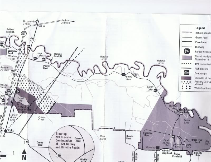
I'm kind of confused by the hunting map for HRNWR. Question for anyone familiar:
The map indicates that the area with the XXs (Bear Creel Canal area) is "Archery Deer and Spring Turkey allowed." This seems to imply that this is the
only area where that hunting is allowed. In other words, the map implies that archery deer and spring turkey is not allowed anywhere else.
However, the rules themselves indicate otherwise:
Access for hunting, fishing, and other public use is permitted on the 11,556 acres of Hatchie River National Wildlife Refuge, except as me be regulated by other provisions, such as special closures fir sanctuaries or by signs on the area.
There are not any "No Hunting" signs in the central area off of Powell road and the few people that I have talked with about hunting here did not indicate anything about being restricted to such a small area.
I am aware of the waterfowl sanctuary closures and the no hunting zone around the headquarters.

