• Help Support TNDeer:

Your Topo and Aerial Help

backstraps

Well-Known Member
Joined
Sep 19, 2003
Messages
8,445
Location
NE Tennessee
I think it would be fun, and good practice for the members if:

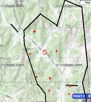
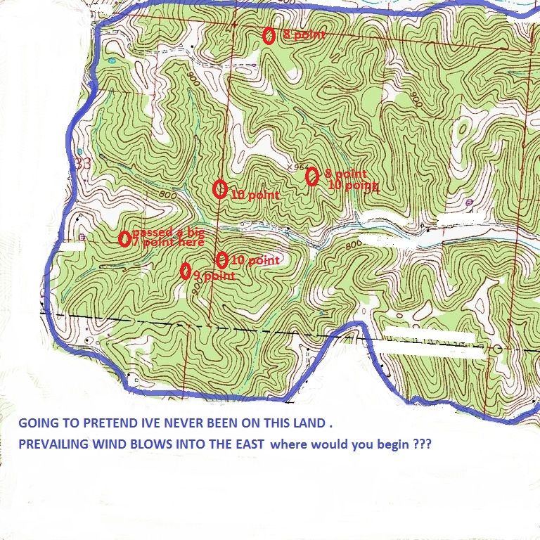
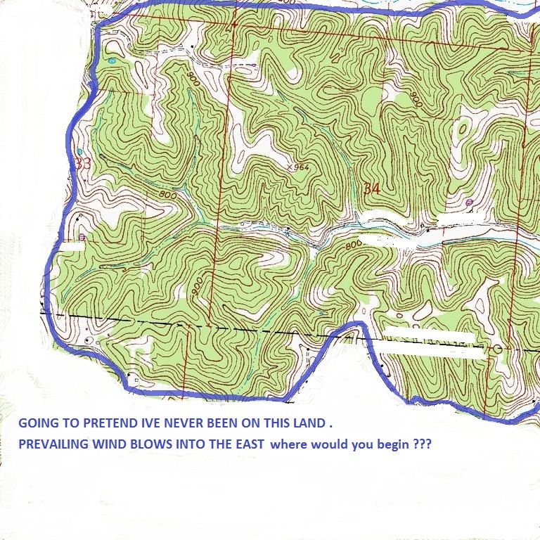
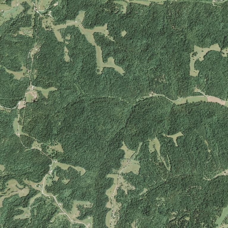
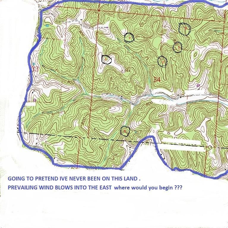
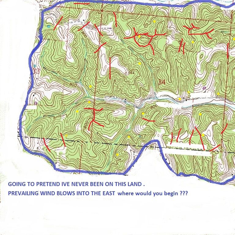
Say you take a topo map and or aerial map, edit the map to not give up any information as to the location, post what you know about the map, such as bedding areas, food sources, and give the prevailing wind for the parcel of property in the map.

Then see if members on here could maybe give some advice the poster hasnt thought of or maybe missed.
 
Okay I will start one off.

This parcel is some land I have hunted about 7 years now.
Lets pretend these was your new lease. You are going to look things over and see where you want to get started.

The wind here is out of the West.

Where and Why would you start.

If you know how to edit my maps and repost your ideas, that would be the most help. If you dont know how I can post instructions.


Here ya go:
TOPO;
topofunb.jpg

AERIAL;
aerialfun.jpg
 
I'd like to see where people would set up on my land/neiboring land based on maps. Im not talented at finding spots via map, but I know some of you are.

White boxes are houses. Try and pic a spot for N,S,E, and W wind directions.

Untitled.png
dededede.png
 
BHC, you have a couple travel routes pinned down for certain.

The red lines that look like a stickman on the lower left, believe this or not, I have two stand locations where you dotted, and have harvested two bucks from that area :)

You have another travel route noted that is a confirmed route as well, but the stand location I have is a bold contour lone away so 100 feet away, had an encounter with a nice 10 point there.

I think deer can be predicted to move via terrain features. I also believe a bucks bedding can be predicted via terrain features as well.
 
Rackseeker, I see your way of thinking as well. Pretty much hunting the funnels and saddles, and the tips of a couple of points.

Rackseeker, and BHC:

I noticed you both highlighted the north facing point on the bottom of my map. The point would have the hunter watch into the hollors.
Why would you guys think this would be a good place? I am just looking for your thoughts and opinions. I have been there, and an old dirt road comes through an open field and the dot you guys have placed is about 40-50 yards from where the road ends on the map
 
Its really hard to say without spending some time walking the property. The reason I marked the stand location on the point of the field edge, is because the good chance of deer travel entering the field at that point and a person could cover both arms of the field if hunting with a rifle. That would be a excellent stand during the chasing phase of the rut.
As far as the spot marked on the north facing point on the bottom of the map. It is just a good spot for traveling bucks. But like I said its hard to know for sure without walking the property.
 
Untitled-2.png


If I was going to hunt this piece of property without scouting. My first stand set would be at the red circle. Can't tell much about the spot on the topo map but the aerial map shows a promising spot at the red circle.
 
Rackseeker said:
Untitled-2.png


If I was going to hunt this piece of property without scouting. My first stand set would be at the red circle. Can't tell much about the spot on the topo map but the aerial map shows a promising spot at the red circle.

Nice pick with that spot. I've never hunted it but my dad killed a nice eight just about 100yrds north back when the field was cleared out. Now it's to grown up because the neighbors don't farm anymore.

What topo service do you guys use? I can't seem to find anything on the net.
 
Rackseeker said:
Backstraps, just for fun mark your topo where you have taken bucks on that piece of property.

These are spots where bucks have been harvested in the last three years. I didnt didnt harvest all these, myself and a couple buddys. I didnt harvest a single deer here last year because I got caught up chasing after a monster! We played the game, that is set to continue Sept this year! :) All these bucks were harvested with stick n string except the nine point.
topofunc.jpg
 
I ordered a big 24" by 36" map from mytopo.com I take pics of it and mark it up on the computer.... Backstraps, I like converging hubs like that, right there you have three hollows comin together you also can hunt it with N-W winds depending. There is a saddle NW of there that could lead bucks out onto those points to the west. I would enter from the road to the SE depending....
 
On your aerial I also think deer using that bottom field to the NE may follow that hollw back to bed particularly the east hillside, bucks may use that hillside w a west wind to scent check scrapes on the way back to bed...
 

Latest posts

Back
Top