• Help Support TNDeer:

Your Topo and Aerial Help

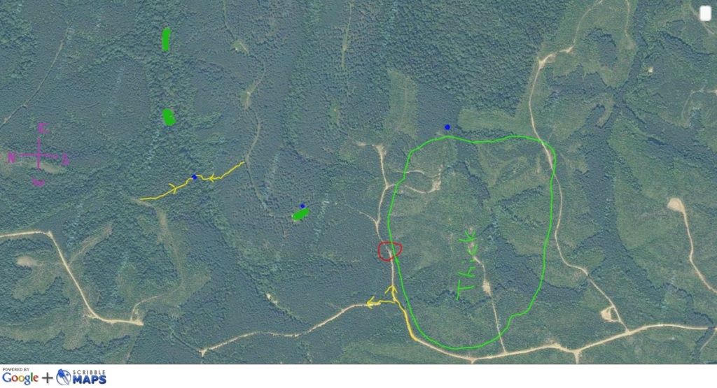
The saddle to the NW has a ton of movement during pre rut when the younger bucks are following and pushing. It seems like the does for whatever reason are no where near that saddle when the older bucks starts playing the game. Im an not sure how much pressure "creeps" from that old road though. Hunters around there knows NO boundaries!

The thing about this piece of property, we dont hammer it too death. There are enough so many ways into the property to hunt where we want to, we try our best to not over pressure the deer.
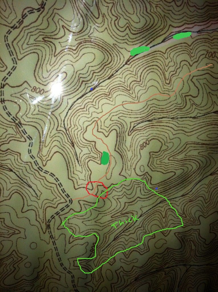
 
Ok heres a section of map probably 400 acres give or take..I beleive the marked thick are is a huge bedding area... untouched by people.. The green blobs are plots marked one Good/used funnel. Current stands are blue.. I also marked where I would be driving in from to SW on aerial.. The yellow on leading to stands are entry routes.. what you would change/ move funnels you see, whatever. what looks stupid.. you will not hurt my feelings, I wanna here your thoughts...
7WefU_L6M4.jpg

Bowl-1.jpg
 
There are couple spots that jump out at me. On a piece of property like this, I love scouting transition lines.(marked with black pen lines) You have some good points coming off the transition lines. There is a good inside corner maybe worth scouting and taking a look at. I marked Red X where I would scout for possible stand sites

The area you have red circled is a good funnel.Just to the right of the red circle on the topo is a nice saddle. The bottom right hand corner of you your green outline showing thick, is another good funnel on the ridge below the thick area.

Im am BY FAR an expert on maps :) Just the red X's are where I would scout outside of the bigger woods.

Nice looking piece of property. I turned your map so that the directions would match up

BHCTndeertransitionlines.jpg
 

Latest posts

Back
Top